Phototheca has a few options for browsing and viewing photos based on their location data.
World Map
Photothecas’ Map view shows your geo-tagged photos pinned to a map. Many cameras, including most smartphones, can record GPS location data when a photo is captured. Phototheca uses that information to create your Map view automatically. If you have photos without GPS data, you can easily add a location to the images, so they appear in the Map view.
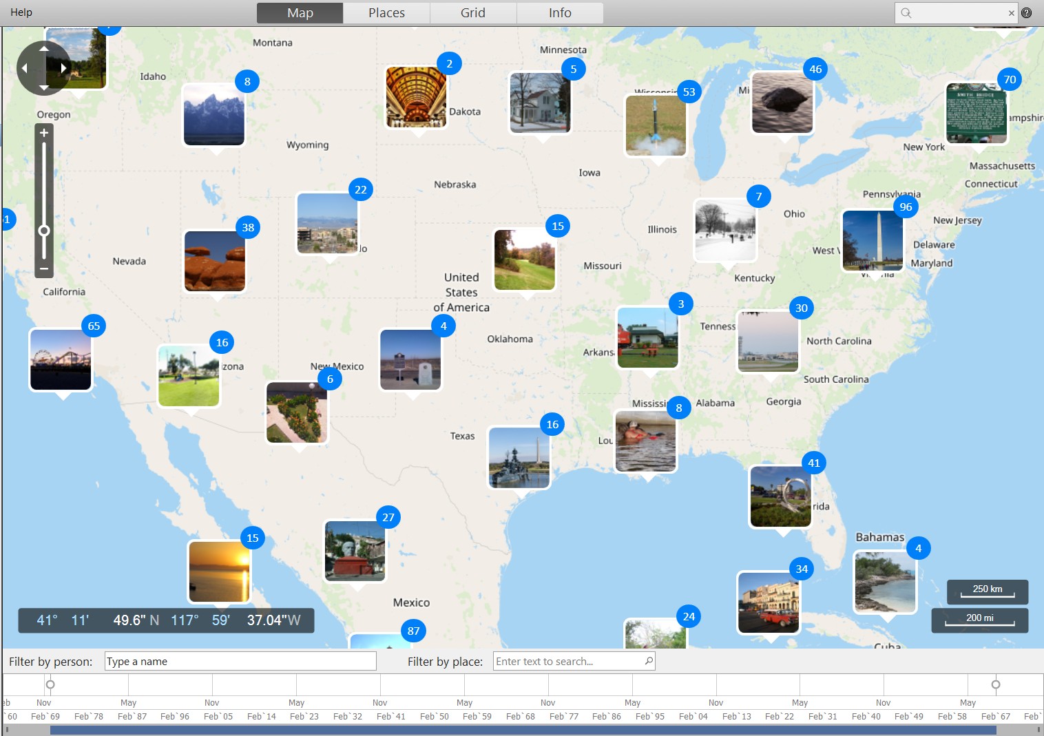
Viewing and Finding Photos in the Map View:
- Open Phototheca and go to the Map view. Photos that contain GPS data will automatically appear on the map.
- To zoom:
- Using a touchscreen or a trackpad – Zoom using a pinch-in and pinch-out gesture.
- Using a mouse – Rotate the mouse wheel, or click the + and – buttons at the left top of the map to Zoom in and out. You can also use the Zoom slider.
- Filter by place: type in the name of a location into the text box to filter photos by location

- Filter by persons: to filter photos and find only those that have certain persons on a photo, use the “Filter by person” box:

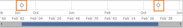
- Filter by date range. There is a timeline beneath the map. The timeline includes the dates of every photo on the map. Drag slider endings to set the needed data range and filter photos:
- To view a set of pinned photos, click or tap on the thumbnail pin to show the photos in grid view.
Places View
Places view shows lists of all address parts divided by hierarchy level. From left to right, there are lists with Countries, States, Cities, and Sublocations. Those lists include only IPTC location data which present in your library.
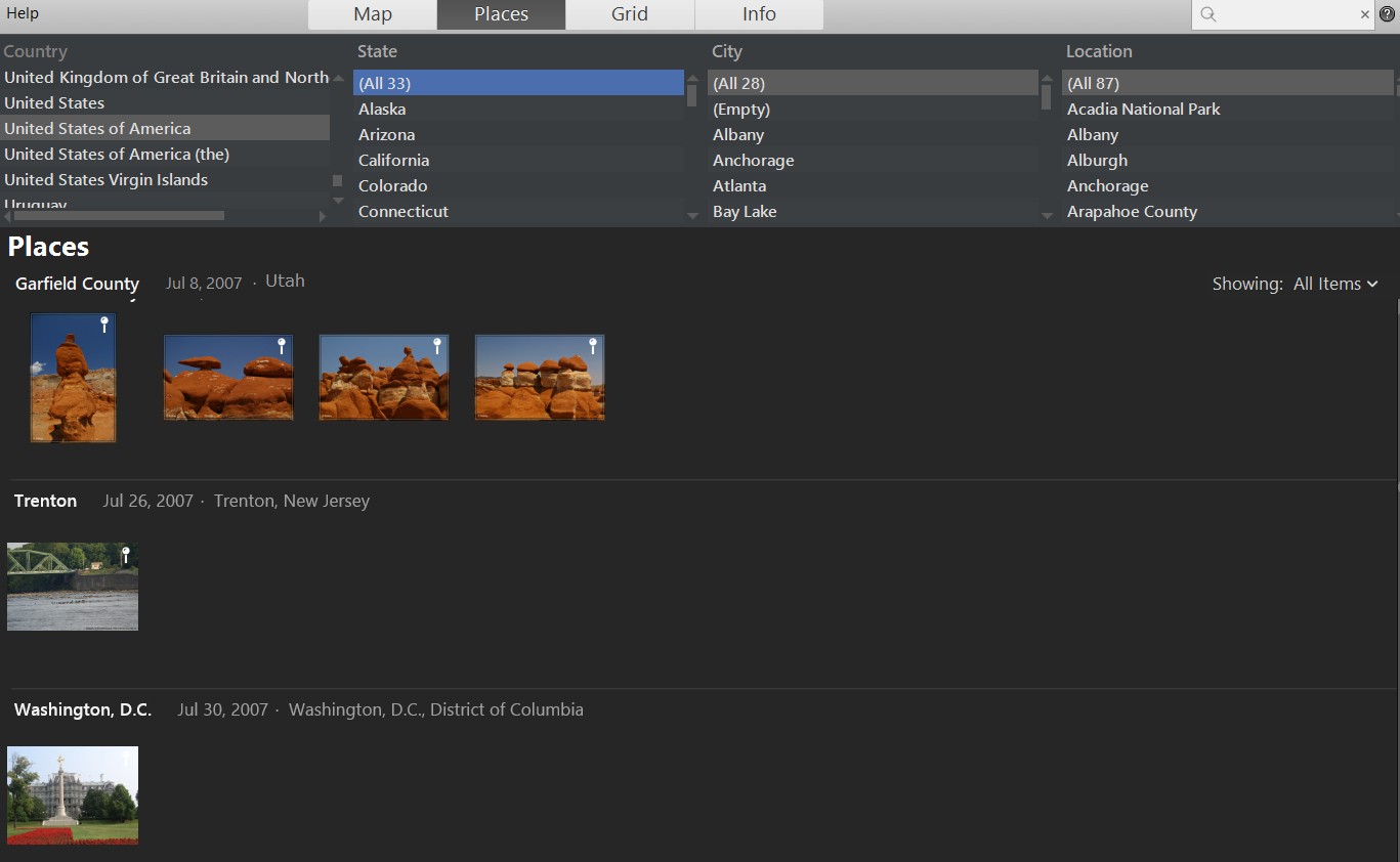
From here, you can select any item in any list and narrow photos to that specific location.
If you select the top-level item – a country, for example, the USA, you will get all photos from this country in the grid below. If you choose a city, the photos will be filtered to show only images from that city below.
This view helps see the actual hierarchy of IPTC locations and their relations to each other.
Here we can spot inconsistency in data; for example, the USA appears in 3 different ways in the country list:

We may want to fix the inconsistency and change the IPTC fields of photos to have the single option of the country name in the library.
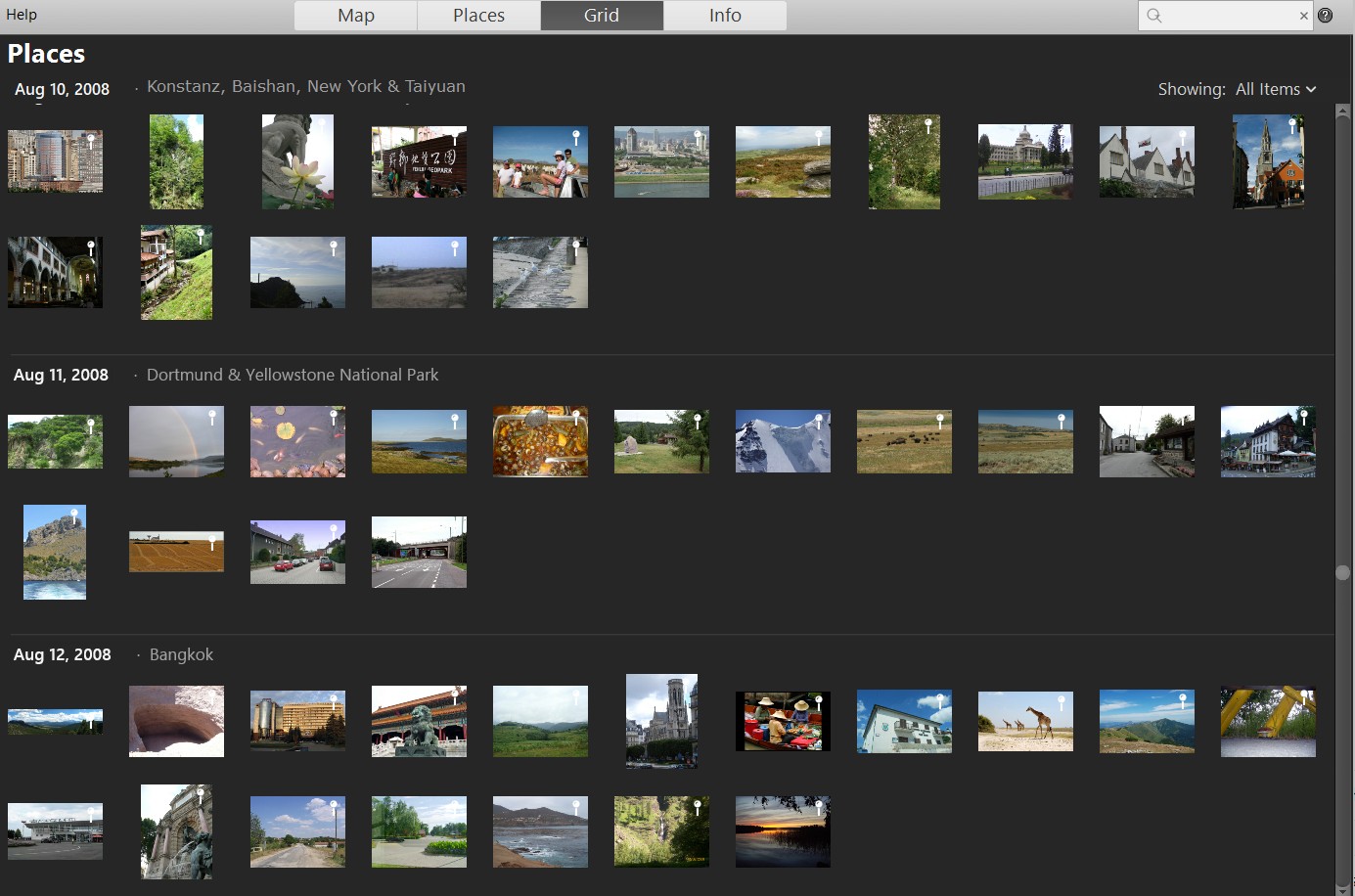
Grid View
The Grid view shows all geo-tagged photos grouped and sorted by shoot date and location.
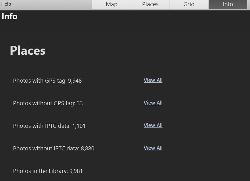
Info View
The Info view shows simple statistics on photos and numbers of geo-tagged and not geo-tagged photos with links to see them.